The 23-24 field season is nearly complete, and we’re highlighting some of the interesting places staff have been studying. One team operating out of the Pensacola Mountains used a portable drill system to drill through ice close to the mountains, to collect a series of subglacial rock cores. The team will then use geochronological methods to establish if the rock has previously been exposed due to the ice sheet being smaller, and for how long this was the case.
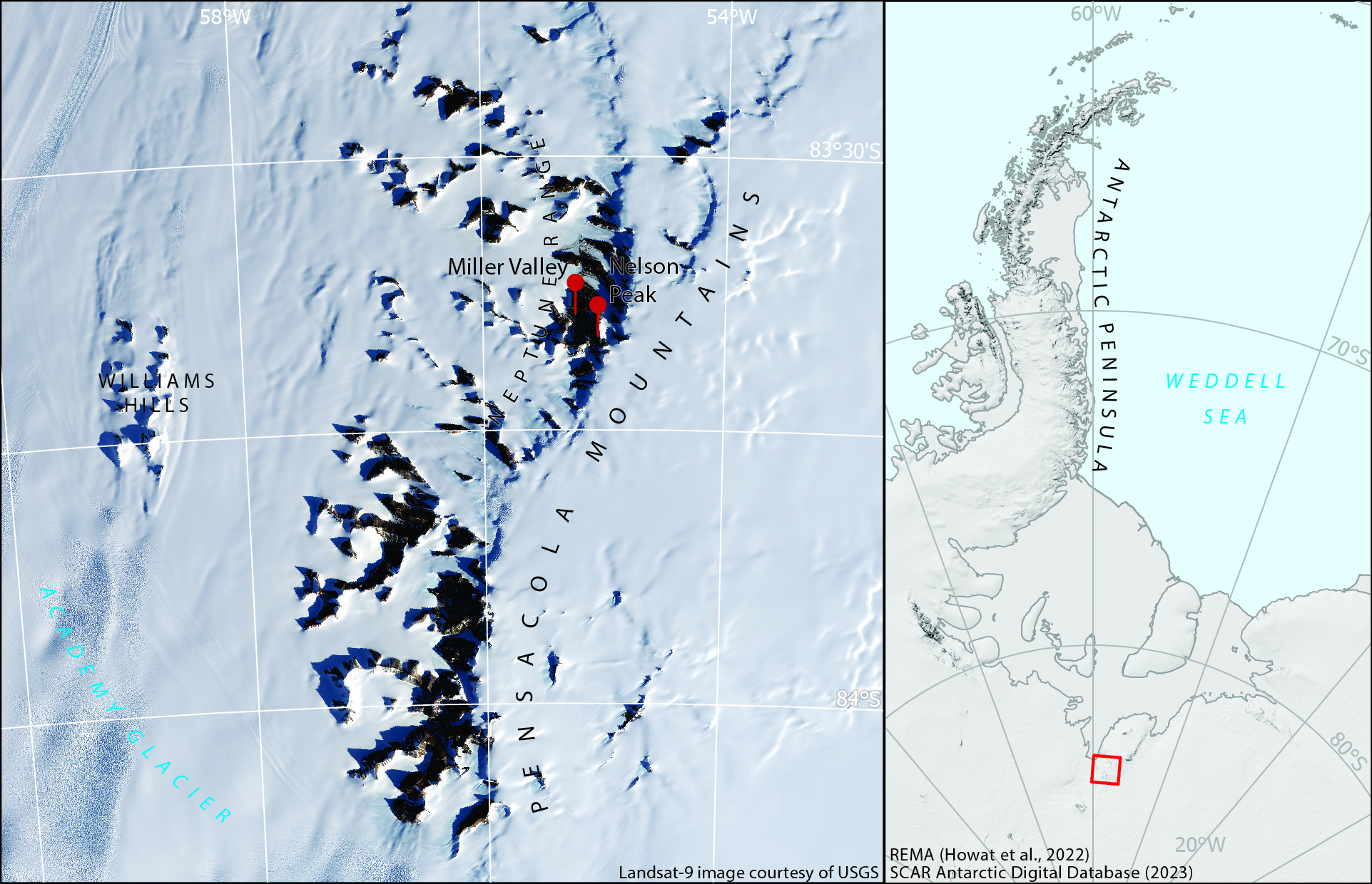
The Pensacola Mountains form part of the Transantarctic Mountain range and were first photographed from the air by the US Navy in 1956. They are named after the US Naval Air Station at Pensacola, Florida. The Neptune Range forms the central part of the Pensacola Mountains and is named for the aircraft used during the 1956 reconnaissance flights – the P2V-2N Neptune aircraft.
Many other features in the area are named for those involved in the USN air photography campaign and subsequent field campaigns in 1961-65. These include Nelson Peak, named for Willis H Nelson, USGS geologist, and Miller Valley, named for Lieut. Donald R. Miller, USN, pilot of R4D aircraft with Squadron VX-6, who provided logistic support for the USGS field party in the area, summer 1963-64 .