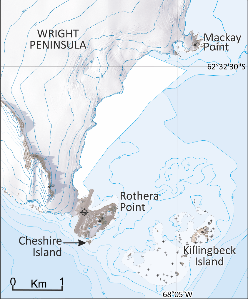
May 3rd was Rothera Day, where Rothera’s role as the logistics hub in Antarctica and the exciting plans for future development were celebrated here at BAS. Rothera Research Station is located on Rothera Point (67° 34′ 10″ S, 68° 07′ 37″ W), Adelaide Island, named after John Rothera, FIDS surveyor for Horseshoe Island (1957-58) and Detaille Island (1958-59). It was first photographed by FIDASE and surveyed by John Rothera and Peter Gibbs in 1957-58 and its northern part was designated a SSSI (now ASPA) in 1986. The point forms the southern extent of Wright Peninsula (67° 27′ 47″ S, 68° 10′ 24″ W) named after Alan Wright, BAS surveyor at Adelaide base (1961-63).
Notable place names in and around the area are associated with the site’s history. Mackay Point (67° 32′ 14″ S, 68° 04′ 27″ W) was named for Donald Mackay, a BAS builder for Halley, Signy, and Rothera. Cheshire Island (67° 34′ 23″ S, 68° 07′ 29″ W) is named after Alan Cheshire who was a BAS radio operator at Faraday and Rothera stations from 1976-79. Similarly, Killingbeck Island (67° 34′ 19″ S, 68° 04′ 30″ W) is named for John Killingbeck, FIDS Base Leader for Deception Island 1961-62, BAS General Assistant for Adelaide Base in 1962-63 and later surveyor on the last dog journey, Alexander Island 1993-94.