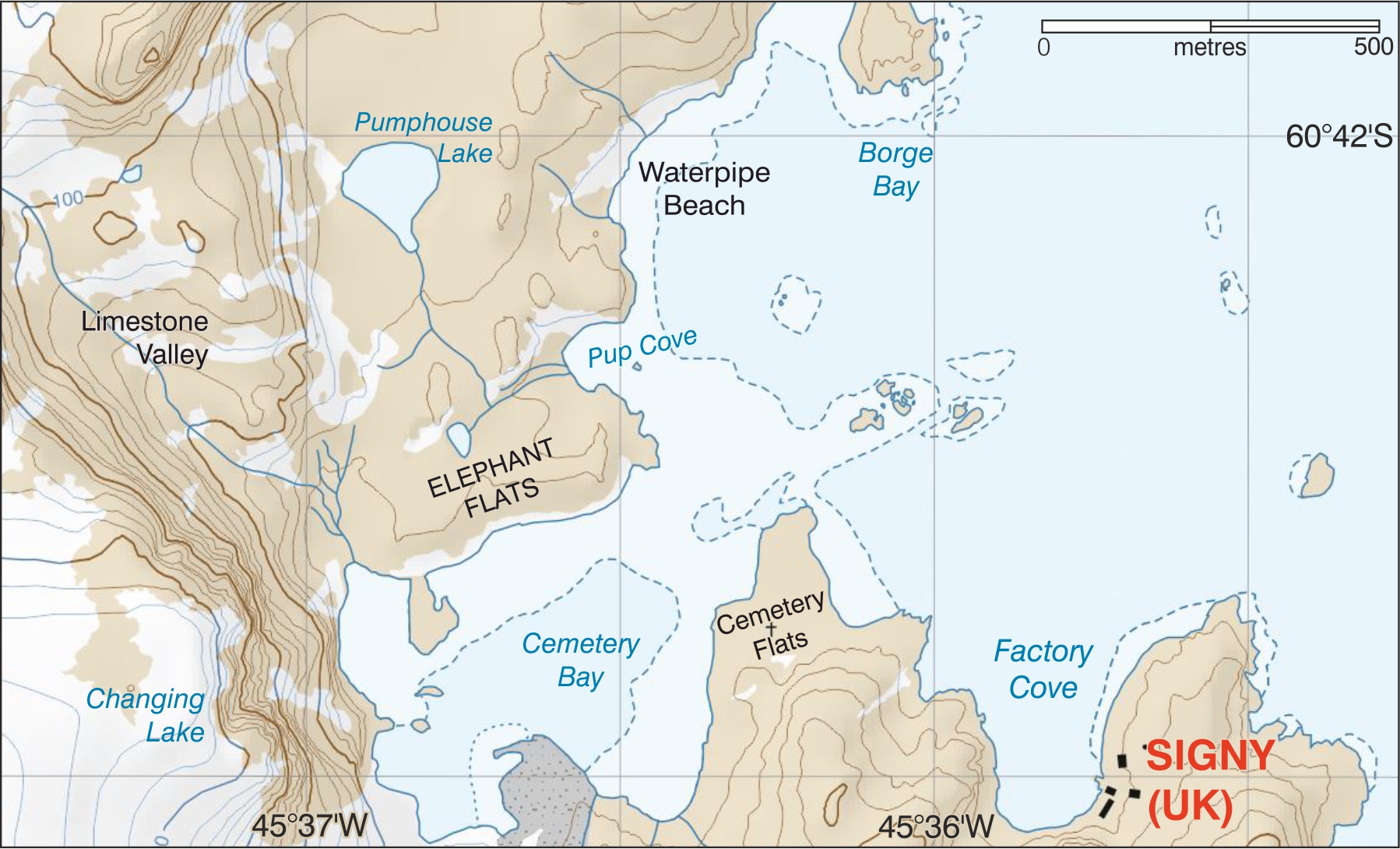
Signy (60° 42′ 29″ S, 45° 35′ 42″ W) was first established in 1947 as “Base H.” Signy Island was roughly charted by Capt. Matthew Brisbane, Master of the cutter Beaufoy, in early 1823 and later in 1912-13 by the whaler Kapt. P. Sørlle, who named the island Signy after his wife Fru Signy. Names in this region come from whaling, local wildlife and descriptions of features. Originally a key anchorage for whaling ships and from 1921 the site of a shore station, many place-names stem from whaling such as Waterpipe Beach and Pumphouse Lake (used for watering whaling ships); Factory Cove (site of whale processing plant); and Borge Bay (after Hans Borge, manager of the factory ship Polynesia). Cemetery Flats and Cove are testament to the hazardous work of whaling.
More recent names originate from the local wildlife. Elephant Flats (60° 42′ 14″ S, 45° 36′ 50″ W) was named after the elephant seals which haul out here, while Pup Cove (60° 42′ 11″ S, 45° 36′ 32″ W) was named for the first recorded birth of a fur seal pup on the island (in February 1977) since Signy station opened. Other names are descriptive; Changing Lake (60° 42′ 29″ S, 45° 37′ 08″ W), comes from how the lake has slowly changed size as the retaining glacier ice retreated. Close by, Limestone Valley (60° 42′ 11″ S, 45° 37′ 16″ W) is named from its exposure of limestone cliffs. The current Signy Island topographic map (2010) is due an update in the coming months – watch this space! For more information on place names and the Antarctic Place-names Committee, please see http://apc.antarctica.ac.uk/.