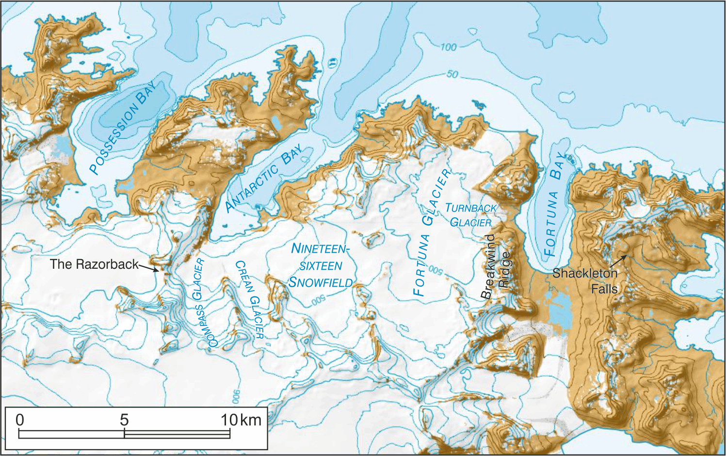
BAS has recently published a new map of South Georgia, which features completely new, detailed mapping for the route of the crossing of the Island by Shackleton, Frank Worsley and Tom Crean in May 1916. This epic journey has inspired many names along the route.
The first difficult pass on their route was The Razorback (54° 09′ 13″ S, 37° 05′ 06″ W). This feature extends between the northern peak of the Trident and Sörlle Peak and is still a major obstacle to parties attempting the Shackleton route. The three men eventually crossed at the most northerly col, descending down to Compass Glacier (54° 09′ 51″ S, 37° 03′ 21″ W), named after Frank Worsley’s compass which was critical to use on the expedition.
They then crossed Crean Glacier and Nineteen-sixteen Snowfield (54° 09′ 53″ S, 36° 57′ 48″ W), named in commemoration of the crossing. Mistaking Fortuna Bay for Stromness Bay, they descended down the aptly named Turnback Glacier (54° 07′ 38″ S, 36° 50′ 38″ W) before retracing their steps and descending through Breakwind Ridge to Whistle Cove - hearing the steam whistle at Stromness reassured the party that they were within reach of safety.
After starting the final climb at Worsley Beach, Tom Crean discovered Crean Lake by breaking through its ice, and then the final obstacle on their journey involved a perilous clamber down what is now Shackleton Falls (54° 09′ 00″ S, 36° 44′ 28″ W) with the aid of just 15 m of rope, before descending Shackleton Valley and finally making contact with Thoralf Sörlle, manager at Stromness whaling station.