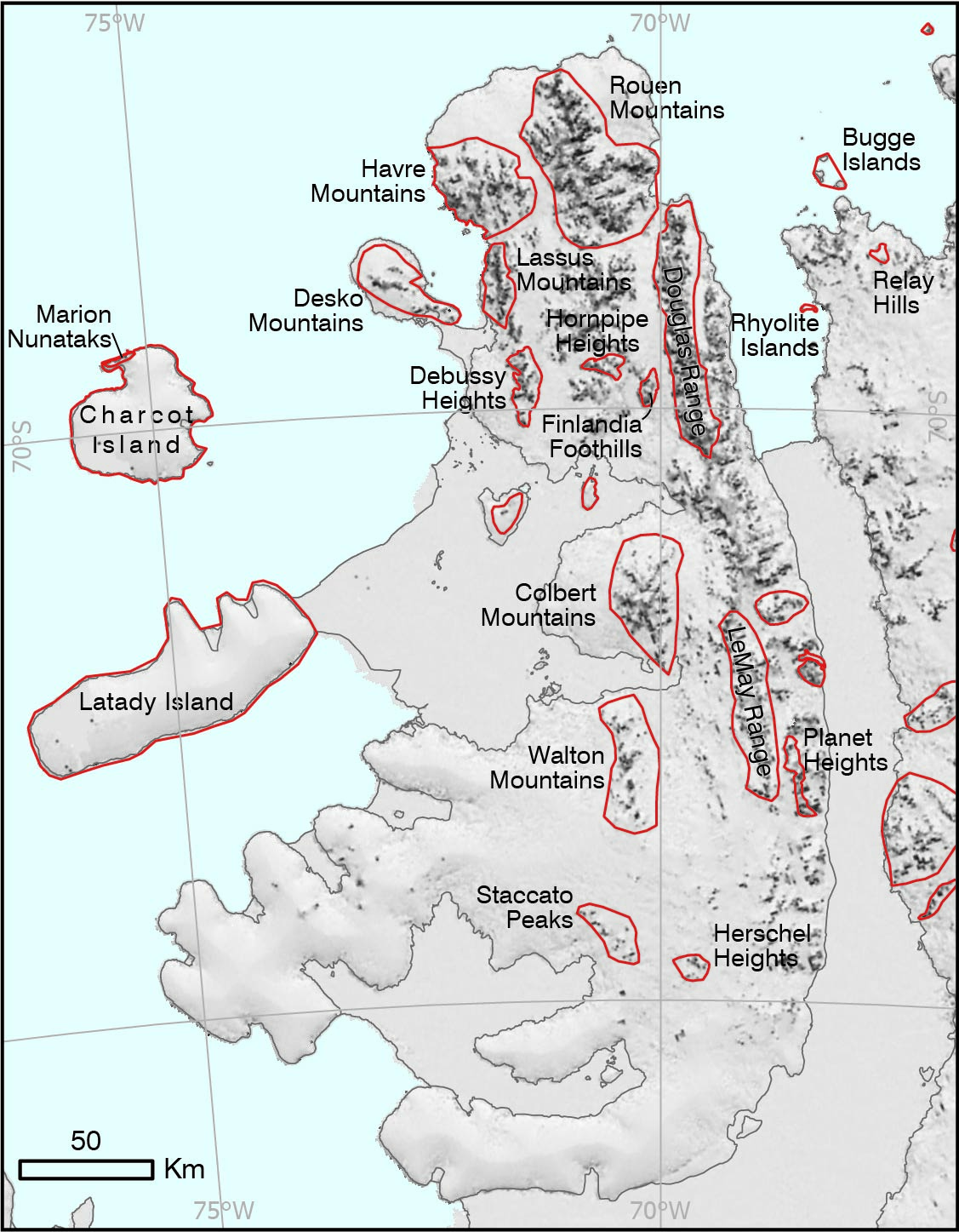
Place names in the British Antarctic Territory gazetteer are currently represented as a point using a coordinate pair with a description of the feature. While this is useful for small features like mountain peaks, it doesn’t work well for larger geographical features.
By using polygons to define these areas, we can better understand the full extent of features in the gazetteer. They provide a way to search for information using spatial analysis and improve clarity over the extent of place name regions, helping with navigation and improving the original dataset.
Over this summer, Alexander Island was used as a case study to explore how we can define features using polygons. This has resulted in a suite of new areas that have been defined through assessment of the individual features that make them up. An example includes the Douglas Range, which runs approximately from Mount Nicholas in the North to Mount Ethelred in the South. We have drawn a polygon around the whole range, so that users of the Gazetteer are now able to visually see the extent of the range. Watch this space for updates as this project develops!